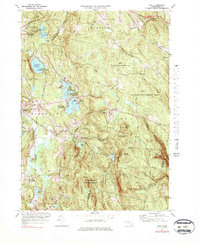
1973 Map of Peru
USGS Topo · Published 1983About this map
The town of Peru and the village of Hinsdale sit at the center of this Berkshire County study, which highlights a landscape shaped by water and recreation in the early 1970s. The region is defined by the high elevations of Peru Hill and French Hill, with drainage flowing west via the Housatonic River (East Branch) and east toward the Westfield River. Notable recreational sites like Camp Taconic, Camp Ashmere, and Camp Danbee line the shores of Ashmere Lake, reflecting the area's mid-century role as a summer destination. Conservation is a prominent theme here, with the Wahconah Falls State Park, the Dorothy Frances Rice Wildlife Refuge, and large tracts of the Middlefield State Forest preserved. For genealogists, the map identifies three distinct burial grounds: Hinsdale Cem, North Cem, and Peru Cem. The Penn Central railroad corridor remains a visible fixture of the local infrastructure, cutting through the river valley near Plunkett Res.
Find a feature on this map
82 named features on this map. Tap any name to fly to it.
Don’t see what you’re looking for? This feature index may not catch every label — zoom into the map to look around manually.
Map Details
Editions of this 1973 Peru Map
3 editions found
Other maps of this area

1886 · Greylock
USGS Topo · 1:62,500

1886 · Hawley
USGS Topo · 1:62,500

1886 · Chesterfield
USGS Topo · 1:62,500

1886 · Becket
USGS Topo · 1:62,500

1888 · Becket
USGS Topo · 1:62,500

1888 · Chesterfield
USGS Topo · 1:62,500

1890 · Hawley
USGS Topo · 1:62,500

1891 · Greylock
USGS Topo · 1:62,500

1893 · Chesterfield
USGS Topo · 1:62,500

1893 · Becket
USGS Topo · 1:62,500