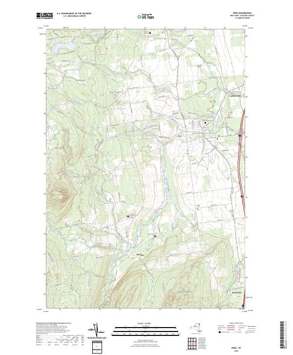
2023 Map of Peru
USGS Topo · Published 2023About this map
The Little Ausable River winds through the heart of Clinton County, defining the agricultural and wooded corridor between the Adirondack foothills and Lake Champlain. This modern topographic study reveals a landscape where historic rural settlements like Peru and Harkness serve as anchors for a network of family-named roads and remote mountain reaches. The western edge is dominated by the transition into Adirondack Park, including the protected lands of Macomb Reservation State Park near Mount Etna.
Find a feature on this map
92 named features on this map. Tap any name to fly to it.
Don’t see what you’re looking for? This feature index may not catch every label — zoom into the map to look around manually.
Map Details
Editions of this 2023 Peru Map
This is the sole edition of this map. No revisions or reprints were ever made.
Other maps of this area

1894 · Plattsburg
USGS Topo · 1:62,500

1895 · Willsboro
USGS Topo · 1:62,500

1895 · Ausable
USGS Topo · 1:62,500

1903 · Ausable
USGS Topo · 1:62,500

1906 · Plattsburg
USGS Topo · 1:62,500

1913 · Dannemora
USGS Topo · 1:62,500

1939 · Plattsburg
USGS Topo · 1:62,500

1941 · Plattsburg
USGS Topo · 1:62,500

1941 · Willsboro
USGS Topo · 1:62,500

1943 · Willsboro
USGS Topo · 1:62,500