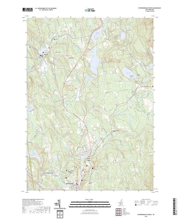
2024 Map of Peterborough North
USGS Topo · Published 2024About this map
The Contoocook River and Nubanusit Brook converge in this corner of southern New Hampshire, defining the historic industrial and residential layout of Peterborough and its neighbor, Hancock. The map details the transition of the region's infrastructure, where the Inactive Rail Trl follows the former path of the railroad through the river valley, now connecting communities like North Village and Elmwood. Local history is deeply embedded in the landscape through numerous burial grounds, including the Old Street Cem and Hillside Cem, while the arts are represented by the sprawling MacDowell Colony west of the river. Significant water management features such as the Edward MacDowell Reservoir and Powder Mill Pond illustrate the mid-century engineering that reshaped the valley's natural drainage for flood control and recreation.
Find a feature on this map
122 named features on this map. Tap any name to fly to it.
Don’t see what you’re looking for? This feature index may not catch every label — zoom into the map to look around manually.
Map Details
Editions of this 2024 Peterborough North Map
This is the sole edition of this map. No revisions or reprints were ever made.
Other maps of this area

1898 · Monadnock
USGS Topo · 1:62,500

1900 · Peterboro
USGS Topo · 1:62,500

1926 · Hillsboro
USGS Topo · 1:62,500

1929 · Hillsboro
USGS Topo · 1:62,500

1930 · Lovewell Mountain
USGS Topo · 1:62,500

1936 · Monadnock
USGS Topo · 1:62,500

1942 · Keene
USGS Topo · 1:125,000

1942 · Lovewell Mountain
USGS Topo · 1:62,500

1943 · Fitchburg
USGS Topo · 1:125,000

1948 · Boston
USGS Topo · 1:250,000