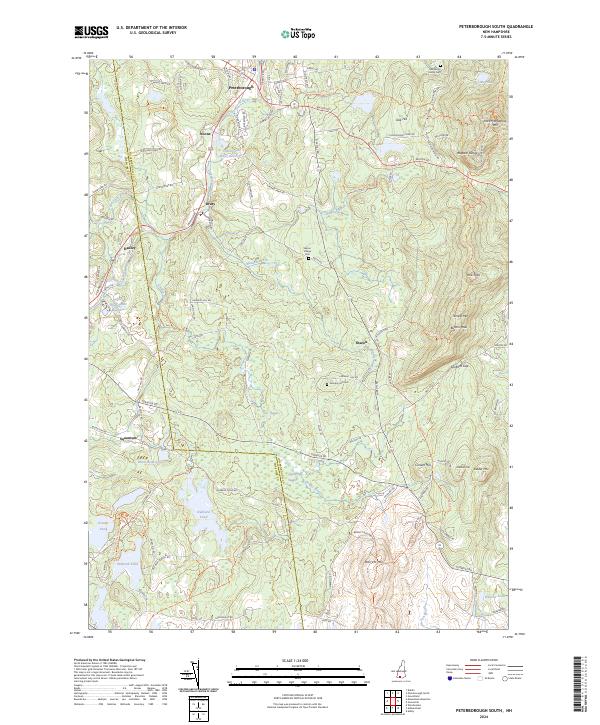
2024 Map of Peterborough South
USGS Topo · Published 2024About this map
Peterborough and the surrounding high country define this landscape, where the Contoocook River flows north through a corridor of small settlements. The terrain rises sharply to the east into the Wapack Range, anchored by peaks such as Pack Monadnock Mtn and Holt Peak. This modern survey reveals a patchwork of conservation lands, most notably the Wapack National Wildlife Refuge, while maintaining a clear view of the area's rural character through small clusters like Noone, Drury, and Hadley.
Find a feature on this map
109 named features on this map. Tap any name to fly to it.
Don’t see what you’re looking for? This feature index may not catch every label — zoom into the map to look around manually.
Map Details
Editions of this 2024 Peterborough South Map
This is the sole edition of this map. No revisions or reprints were ever made.
Other maps of this area

1887 · Winchendon
USGS Topo · 1:62,500

1887 · Fitchburg
USGS Topo · 1:62,500

1889 · Fitchburg
USGS Topo · 1:62,500

1890 · Winchendon
USGS Topo · 1:62,500

1893 · Fitchburg
USGS Topo · 1:62,500

1894 · Winchendon
USGS Topo · 1:62,500

1898 · Monadnock
USGS Topo · 1:62,500

1900 · Peterboro
USGS Topo · 1:62,500

1931 · Fitchburg
USGS Topo · 1:48,000

1932 · Winchendon
USGS Topo · 1:48,000