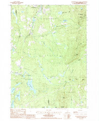
1987 Map of Peterborough South
USGS Topo · Published 1987About this map
The Temple Mountain Range anchors the eastern edge of this 1980s landscape, where the long-distance Wapack Trail traverses summits like Pack Monadnock Mountain and Holt Peak. This region of southern New Hampshire is defined by a heavy presence of conserved lands and water resources, including the expansive Annett State Forest and the Casalis State Forest. The drainage patterns of the Contoocook River and Gridley River carve through the center, feeding numerous high-elevation water bodies such as Hubbard Pond and Cunningham Pond.
Find a feature on this map
47 named features on this map. Tap any name to fly to it.
Don’t see what you’re looking for? This feature index may not catch every label — zoom into the map to look around manually.
Map Details
Editions of this 1987 Peterborough South Map
This is the sole edition of this map. No revisions or reprints were ever made.
Other maps of this area

1887 · Winchendon
USGS Topo · 1:62,500

1887 · Fitchburg
USGS Topo · 1:62,500

1889 · Fitchburg
USGS Topo · 1:62,500

1890 · Winchendon
USGS Topo · 1:62,500

1893 · Fitchburg
USGS Topo · 1:62,500

1894 · Winchendon
USGS Topo · 1:62,500

1898 · Monadnock
USGS Topo · 1:62,500

1900 · Peterboro
USGS Topo · 1:62,500

1931 · Fitchburg
USGS Topo · 1:48,000

1932 · Winchendon
USGS Topo · 1:48,000