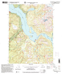
1997 Map of Petersburg B-1
USGS Topo · Published 2000About this map
Wrangell Island and the surrounding coastal waters of the Tongass National Forest are shown here as they appeared in the late 1990s, based on earlier surveys and mid-century topography. The map details a complex landscape of maritime channels and glaciated peaks, where industry and recreation intersect. Evidence of past activity remains visible at the Sawmill Ruins on the shores of Eastern Passage and the Cabin Ruins near Madan Bay, reflecting the region's long-standing connection to timber and sea-based livelihoods.
Find a feature on this map
52 named features on this map. Tap any name to fly to it.
Don’t see what you’re looking for? This feature index may not catch every label — zoom into the map to look around manually.
Map Details
Editions of this 1997 Petersburg B-1 Map
This is the sole edition of this map. No revisions or reprints were ever made.
Other maps of this area

1948 · Petersburg A-1
USGS Topo · 1:63,360

1948 · Petersburg A-2
USGS Topo · 1:63,360

1948 · Petersburg C-1
USGS Topo · 1:63,360

1948 · Petersburg C-2
USGS Topo · 1:63,360

1948 · Petersburg B-2
USGS Topo · 1:63,360

1948 · Petersburg B-1
USGS Topo · 1:63,360

1951 · Bradfield Canal
USGS Topo · 1:250,000

1951 · Petersburg C-2
USGS Topo · 1:63,360

1951 · Petersburg A-1
USGS Topo · 1:63,360

1952 · Petersburg
USGS Topo · 1:250,000