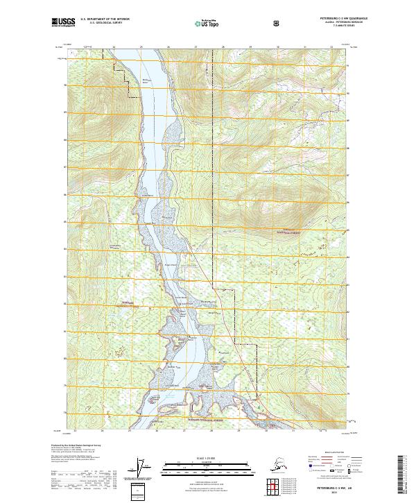
2021 Map of Petersburg C-3 NW
USGS Topo · Published 2021About this map
Wrangell Narrows serves as a critical maritime corridor in this coastal Alaskan landscape, separating the Lindenberg Peninsula from the recreation-heavy interior of Tongass National Forest. The map documents a complex shoreline of points, flats, and navigational hazards, including the California Boulder Patch, Colorado Reef, and North Ledge. Inland, the terrain is defined by a modern network of seasonal trails and access roads, such as the Frenchy Ridge Snowmobile Trail Trl and Twin Ridge Ski Trl, reflecting a landscape managed for both timber and outdoor utility. Notable coastal features like Halfmoon Anchorage and Spruce Point highlight the historical and ongoing importance of small-craft navigation along the Mitkof Highway corridor, while the North Blind River Trl marks the southeastern transition toward the North Blind River.
Find a feature on this map
52 named features on this map. Tap any name to fly to it.
Don’t see what you’re looking for? This feature index may not catch every label — zoom into the map to look around manually.
Map Details
Editions of this 2021 Petersburg C-3 NW Map
This is the sole edition of this map. No revisions or reprints were ever made.
Other maps of this area

1948 · Petersburg C-4
USGS Topo · 1:63,360

1948 · Petersburg C-3
USGS Topo · 1:63,360

1951 · Petersburg D-4
USGS Topo · 1:63,360

1951 · Petersburg C-4
USGS Topo · 1:63,360

1952 · Petersburg
USGS Topo · 1:250,000

1953 · Petersburg C-3
USGS Topo · 1:63,360

1960 · Petersburg
USGS Topo · 1:250,000

1961 · Petersburg D-3
USGS Topo · 1:63,360
1992 · Petersburg D-4 SE
USGS Topo · 1:25,000
1992 · Petersburg C-3 SW
USGS Topo · 1:25,000