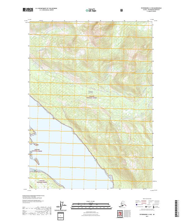
2021 Map of Petersburg C-4 NE
USGS Topo · Published 2021About this map
Lindenberg Peninsula dominates this coastal survey, where the dense wilderness of the Tongass National Forest meets the tidal waters of Duncan Canal. This maritime landscape is defined by its dramatic relief and steep drainages, such as Brown Creek, which flow toward the shoreline. The map reveals a specific network of forest routes, including Mitchell-Tonka, Schia-De-De, and Gelch-De, illustrating how transportation and access are managed within this southeastern Alaska timber and conservation corridor. The lack of permanent settlements emphasizes the region's character as a working forest and maritime passage rather than a residential hub, providing a detailed look at the land's topographical structure before the impact of significant modern development.
Find a feature on this map
11 named features on this map. Tap any name to fly to it.
Don’t see what you’re looking for? This feature index may not catch every label — zoom into the map to look around manually.
Map Details
Editions of this 2021 Petersburg C-4 NE Map
This is the sole edition of this map. No revisions or reprints were ever made.
Other maps of this area

1948 · Petersburg C-4
USGS Topo · 1:63,360

1948 · Petersburg C-3
USGS Topo · 1:63,360

1951 · Petersburg D-4
USGS Topo · 1:63,360

1951 · Petersburg C-4
USGS Topo · 1:63,360

1952 · Petersburg
USGS Topo · 1:250,000

1953 · Petersburg C-3
USGS Topo · 1:63,360

1960 · Petersburg
USGS Topo · 1:250,000

1961 · Petersburg D-3
USGS Topo · 1:63,360
1992 · Petersburg D-4 SE
USGS Topo · 1:25,000
1992 · Petersburg C-3 SW
USGS Topo · 1:25,000