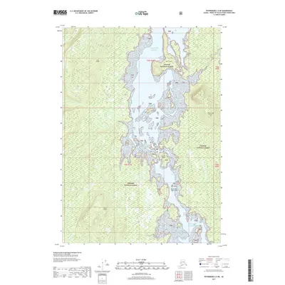
2017 Map of Petersburg C-6 NE
USGS Topo · Published 2017About this map
Keku Strait serves as the central waterway in this 2017 study of the Alexander Archipelago, dividing the shorelines of Kuiu Island to the west and Kupreanof Island to the east. This maritime environment is defined by a complex network of small islands and navigational narrows, including the intricate waters of Rocky Pass and the tight squeeze at The Summit. The entire landmass shown falls within the Tongass National Forest, illustrating a landscape of tidal flats and wooded coastlines largely untouched by modern development. Significant coastal features like Summit Island, Beck Island, and the uniquely named Brown Bear Head Island punctuate the strait, while drainage from the interior is marked by Mud Cr and Irish Cr. The map provides a detailed view of the inter-island passages and high-tide zones that have long dictated movement through this section of Southeast Alaska.
Find a feature on this map
19 named features on this map. Tap any name to fly to it.
Don’t see what you’re looking for? This feature index may not catch every label — zoom into the map to look around manually.
Map Details
Editions of this 2017 Petersburg C-6 NE Map
This is the sole edition of this map. No revisions or reprints were ever made.
Other maps of this area

1948 · Petersburg D-6
USGS Topo · 1:63,360

1948 · Petersburg C-6
USGS Topo · 1:63,360

1948 · Petersburg C-5
USGS Topo · 1:63,360

1948 · Petersburg D-5
USGS Topo · 1:63,360

1951 · Petersburg D-6
USGS Topo · 1:63,360

1951 · Petersburg C-5
USGS Topo · 1:63,360

1952 · Petersburg
USGS Topo · 1:250,000

1960 · Petersburg
USGS Topo · 1:250,000
1995 · Petersburg D-6
USGS Topo · 1:63,360
2017 · Petersburg C-5 NW
USGS Topo · 1:25,000