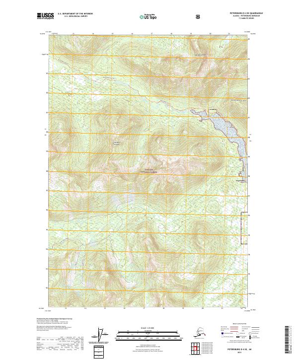
2021 Map of Petersburg D-4 SE
USGS Topo · Published 2021About this map
The Lindenberg Peninsula and the island of Kupreanof dominate this coastal Alaskan landscape, situated within the expansive Tongass National Forest. The map documents a rugged interior of peaks and waterways, notably Del Monte Peak and Petersburg Mtn. Drainage patterns are defined by Petersburg Creek, which flows into the surrounding waters, and several smaller tributaries such as Coho Cr and Duncan Cr.
Find a feature on this map
15 named features on this map. Tap any name to fly to it.
Don’t see what you’re looking for? This feature index may not catch every label — zoom into the map to look around manually.
Map Details
Editions of this 2021 Petersburg D-4 SE Map
This is the sole edition of this map. No revisions or reprints were ever made.
Other maps of this area

1948 · Petersburg C-4
USGS Topo · 1:63,360

1948 · Petersburg C-3
USGS Topo · 1:63,360

1951 · Petersburg D-4
USGS Topo · 1:63,360

1951 · Petersburg C-4
USGS Topo · 1:63,360

1952 · Petersburg
USGS Topo · 1:250,000

1953 · Petersburg C-3
USGS Topo · 1:63,360

1960 · Petersburg
USGS Topo · 1:250,000

1961 · Petersburg D-3
USGS Topo · 1:63,360
1992 · Petersburg D-4 SE
USGS Topo · 1:25,000
1992 · Petersburg D-3 SW
USGS Topo · 1:25,000