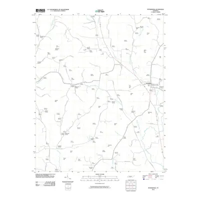
2010 Map of Petersburg
USGS Topo · Published 2010About this map
Petersburg serves as the central hub of this Tennessee landscape, where the Petersburg Post Office and several local landmarks like Gaunt Hill sit near the confluence of Sanders Creek and Cane Creek. The surrounding area is defined by a dense network of family-named hollows and ridges, such as Caneer Hollow, Wakefield Hollow, and Maple Hill Ridge, reflecting generations of local land use and settlement. The map is particularly rich for genealogical research, documenting dozens of burial sites including the Cumberland Cemetery, Mount Zion Cemetery, and Old Orchard Cemetery. Drainage patterns are clearly marked by Pleasant Valley Creek and Swan Creek, which carve through the terrain to create distinctive features like Saddle Gap and Whorley Leonard Bluff. This topography, coupled with named roads like Ostella Rd and Delina Rd, illustrates the rural connectivity between the small valley communities and the more elevated reaches of Porter Hill and Welch Hill.
Find a feature on this map
137 named features on this map. Tap any name to fly to it.
Don’t see what you’re looking for? This feature index may not catch every label — zoom into the map to look around manually.
Map Details
Editions of this 2010 Petersburg Map
This is the sole edition of this map. No revisions or reprints were ever made.
Other maps of this area

1936 · Belfast
USGS Topo · 1:24,000

1936 · Cornersville
USGS Topo · 1:24,000

1936 · Lewisburg
USGS Topo · 1:24,000

1936 · Belleville
USGS Topo · 1:24,000

1936 · Boonshill
USGS Topo · 1:24,000

1936 · Petersburg
USGS Topo · 1:24,000

1936 · Bedford
USGS Topo · 1:24,000

1936 · Frankewing
USGS Topo · 1:24,000

1936 · Fayetteville
USGS Topo · 1:24,000

1944 · Shelbyville
USGS Topo · 1:100,000