
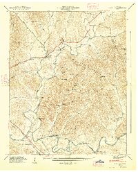
1936 Map of Fayetteville
USGS Topo · Published 1936About this map
Fayetteville serves as the focal point of this 1936 survey, situated where the Nashville Chattanooga and St Louis Railway meets the Elk River. The map captures a transitional moment for Lincoln County, showing the heavy infrastructure of the Tennessee Electric Power Company Transmission Line and a CCC Camp TVA No 33 north of the river, reflecting Depression-era public works projects.
Find a feature on this map
54 named features on this map. Tap any name to fly to it.
Don’t see what you’re looking for? This feature index may not catch every label — zoom into the map to look around manually.
Map Details
Editions of this 1936 Fayetteville Map
This is the sole edition of this map. No revisions or reprints were ever made.
Other maps of this area

1936 · Booneville
USGS Topo · 1:24,000

1936 · Flintville
USGS Topo · 1:24,000

1936 · Taft
USGS Topo · 1:24,000

1936 · Belleville
USGS Topo · 1:24,000

1936 · Boonshill
USGS Topo · 1:24,000

1936 · Petersburg
USGS Topo · 1:24,000

1936 · Lincoln
USGS Topo · 1:24,000

1936 · Mulberry
USGS Topo · 1:24,000

1944 · Shelbyville
USGS Topo · 1:100,000
1947 · Mulberry
USGS Topo · 1:24,000
Featured Places
- Fayetteville, TN
- Creson, Fayetteville
- Madden Homes, Fayetteville
- Elmwood Terrace, Fayetteville
- Howell, TN