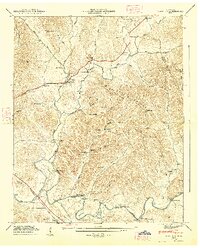
1947 Map of Mulberry
USGS Topo · Published 1948About this map
Mulberry stands as a central hub in this post-war landscape, where the confluence of the West Fork and East Fork feeds into Mulberry Creek. The terrain is defined by deep drainage patterns, such as Taylor Hollow and Moorhead Hollow, which funnel water toward the winding Elk River in the south. The rural character of the era is evidenced by the density of family burial grounds, including Whitaker Cem and Sullivan Cem, suggesting a long-settled agricultural community.
Find a feature on this map
66 named features on this map. Tap any name to fly to it.
Don’t see what you’re looking for? This feature index may not catch every label — zoom into the map to look around manually.
Map Details
Editions of this 1947 Mulberry Map
3 editions found
Other maps of this area

1936 · Booneville
USGS Topo · 1:24,000

1936 · Flintville
USGS Topo · 1:24,000

1936 · Cumberland Springs
USGS Topo · 1:24,000

1936 · Belleville
USGS Topo · 1:24,000

1936 · Lincoln
USGS Topo · 1:24,000

1936 · Huntland
USGS Topo · 1:24,000

1936 · Mulberry
USGS Topo · 1:24,000

1936 · Fayetteville
USGS Topo · 1:24,000

1936 · Lois
USGS Topo · 1:24,000

1941 · Cumberland Springs
USGS Topo · 1:24,000