
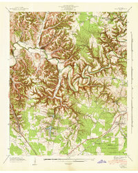
1936 Map of Cumberland Springs
USGS Topo · Published 1936About this map
Lynchburg serves as the western anchor of this Moore County landscape as it appeared in the mid-1930s, showing a transition from the structured streets of the town to the intricate network of hollows and ridges to the east. The terrain is defined by a dense web of watercourses, including Mulberry Creek, Hurricane Creek, and Turkey Creek, which carved out names like Bobo Hollow and Gourdneck Hollow. A high concentration of community landmarks reveals a rural social structure anchored by small schools and churches, such as Raysville Sch, Smith Chapel, and Mt Ethel Ch.
Find a feature on this map
75 named features on this map. Tap any name to fly to it.
Don’t see what you’re looking for? This feature index may not catch every label — zoom into the map to look around manually.
Map Details
Editions of this 1936 Cumberland Springs Map
This is the sole edition of this map. No revisions or reprints were ever made.
Other maps of this area

1928 · Decherd
USGS Topo · 1:62,500

1936 · Ovoca
USGS Topo · 1:24,000

1936 · Booneville
USGS Topo · 1:24,000

1936 · Shelbyville
USGS Topo · 1:24,000

1936 · Belvidere
USGS Topo · 1:24,000

1936 · Mulberry
USGS Topo · 1:24,000

1936 · Camp Peay
USGS Topo · 1:24,000

1936 · Normandy
USGS Topo · 1:24,000

1936 · Lois
USGS Topo · 1:24,000
1941 · Ovoca
USGS Topo · 1:24,000