
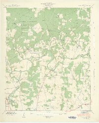
1936 Map of Belvidere
USGS Topo · Published 1936About this map
The Elk River winds through this 1936 survey of Franklin County, defining a landscape of river-bottom agriculture and upland hollows. The rural economy is anchored by the Nashville Chattanooga and St Louis Railway and a network of named bridges like Lee Ford Bridge and Lockmiller Bridge. Cultural life is densely recorded through numerous local institutions, including Little Hurricane Ch, Bethel Ch, and more than half a dozen community schools such as Oak Grove Sch and Union Hill Sch.
Find a feature on this map
69 named features on this map. Tap any name to fly to it.
Don’t see what you’re looking for? This feature index may not catch every label — zoom into the map to look around manually.
Map Details
Editions of this 1936 Belvidere Map
This is the sole edition of this map. No revisions or reprints were ever made.
Other maps of this area

1928 · Decherd
USGS Topo · 1:62,500

1936 · Cumberland Springs
USGS Topo · 1:24,000

1936 · Beans Creek
USGS Topo · 1:24,000

1936 · Winchester
USGS Topo · 1:24,000

1936 · Huntland
USGS Topo · 1:24,000

1936 · Pitcher Ridge
USGS Topo · 1:24,000

1936 · Camp Peay
USGS Topo · 1:24,000

1936 · Capitol Hill
USGS Topo · 1:24,000

1936 · Lois
USGS Topo · 1:24,000
1941 · Capitol Hill
USGS Topo · 1:24,000