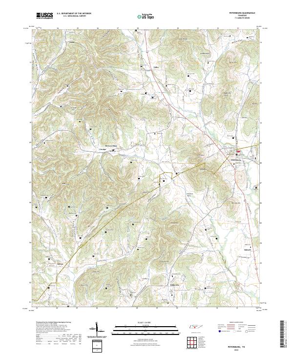
2022 Map of Petersburg
USGS Topo · Published 2022About this map
The boundary between Marshall Co and Lincoln Co runs through a landscape defined by sharp ridges and deep hollows, where family-named cemeteries and small settlements like Petersburg and Delina cluster along the valley floors. This area of Middle Tennessee is particularly rich in genealogical landmarks, with numerous burial grounds such as Pigg Family Cem, Cumberland Cem, and Tuley Cem established near the headwaters of local streams. The topography is etched with named drainages like Richland Cr and Swan Cr, which flow through the complex network of depressions including Goshen Hollow and Hampton Hollow. Evidence of former transportation routes is visible in the corridor of the Old Railroad Bed Rd, which parallels the modern road network near Bidwell and Blakeville. These infrastructure markers, combined with the concentration of upland features like Leonard Bluff and Toll Gate Hill, illustrate a rural Tennessee community shaped by the limestone-carved terrain and the needs of decentralized agricultural hamlets.
Find a feature on this map
162 named features on this map. Tap any name to fly to it.
Don’t see what you’re looking for? This feature index may not catch every label — zoom into the map to look around manually.
Map Details
Editions of this 2022 Petersburg Map
This is the sole edition of this map. No revisions or reprints were ever made.
Other maps of this area

1936 · Belfast
USGS Topo · 1:24,000

1936 · Cornersville
USGS Topo · 1:24,000

1936 · Lewisburg
USGS Topo · 1:24,000

1936 · Belleville
USGS Topo · 1:24,000

1936 · Boonshill
USGS Topo · 1:24,000

1936 · Petersburg
USGS Topo · 1:24,000

1936 · Bedford
USGS Topo · 1:24,000

1936 · Frankewing
USGS Topo · 1:24,000

1936 · Fayetteville
USGS Topo · 1:24,000

1944 · Shelbyville
USGS Topo · 1:100,000