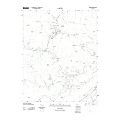
2010 Map of Petros
USGS Topo · Published 2010About this map
Frozen Head Mountain dominates the northern landscape of this Morgan County terrain, where the legacy of regional industry and institutional history is clearly etched into the hollows. The settlement at Petros Post Office sits at the heart of a complex mining and correctional landscape, featuring the Brushy Mountain Prison Cemetery and nearby Brushy Mountain Number 7 Mine. The geography is defined by deep incisions like Sawmill Hollow and Rankin Hollow, illustrating how development followed the narrow valley floors between steep ridges. Numerous family and community burial sites, such as the Joe Goddard Cemetery and Stephens Cemetery, are scattered along the winding road network, including Petros Joyner School Rd. In the southern reaches, the character shifts toward small crossroads like White Schoolhouse Corners and broader valleys drained by Jones Creek, showing a transition from heavy extraction to rural community life.
Find a feature on this map
95 named features on this map. Tap any name to fly to it.
Don’t see what you’re looking for? This feature index may not catch every label — zoom into the map to look around manually.
Map Details
Editions of this 2010 Petros Map
This is the sole edition of this map. No revisions or reprints were ever made.
Other maps of this area

1887 · Kingston
USGS Topo · 1:125,000

1891 · Kingston
USGS Topo · 1:125,000

1893 · Briceville
USGS Topo · 1:125,000

1893 · Kingston
USGS Topo · 1:125,000

1895 · Wartburg
USGS Topo · 1:125,000

1895 · Loudon
USGS Topo · 1:125,000

1895 · Briceville
USGS Topo · 1:125,000

1896 · Wartburg
USGS Topo · 1:125,000

1896 · Briceville
USGS Topo · 1:125,000

1935 · Gobey
USGS Topo · 1:24,000