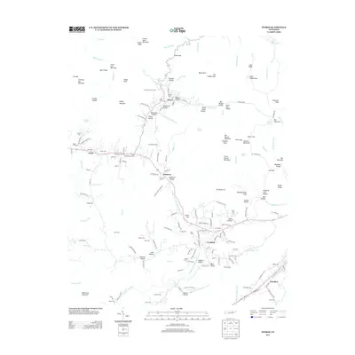
2013 Map of Petros
USGS Topo · Published 2013About this map
Frozen Head Mountain looms over the northern edge of this landscape, where the settlement of Petros sits at the foot of Armes Gap. The area’s complex history is anchored by the Brushy Mtn Prison Cem, while numerous family and community burial grounds, such as Brasel Cem, Langley Cem, and Adkins Cem, are scattered across the winding hollows. The settlement pattern follows the drainage of Crooked Fork and Williams Cr, with small communities like Stephens, Coalfield, and Union connected by a network of rural roads including Beech Fork Rd and Rattle Snake Rd. The southern portion of the quadrangle shows the waters of the Little Emery River and Middle Fork Little Emery River as they thread through the terrain near Back Valley. This map provides a clear record of the enduring rural character and genealogical footprint of these mountain gaps and valleys.
Find a feature on this map
180 named features on this map. Tap any name to fly to it.
Don’t see what you’re looking for? This feature index may not catch every label — zoom into the map to look around manually.
Map Details
Editions of this 2013 Petros Map
This is the sole edition of this map. No revisions or reprints were ever made.
Other maps of this area

1887 · Kingston
USGS Topo · 1:125,000

1891 · Kingston
USGS Topo · 1:125,000

1893 · Briceville
USGS Topo · 1:125,000

1893 · Kingston
USGS Topo · 1:125,000

1895 · Wartburg
USGS Topo · 1:125,000

1895 · Loudon
USGS Topo · 1:125,000

1895 · Briceville
USGS Topo · 1:125,000

1896 · Wartburg
USGS Topo · 1:125,000

1896 · Briceville
USGS Topo · 1:125,000

1935 · Gobey
USGS Topo · 1:24,000