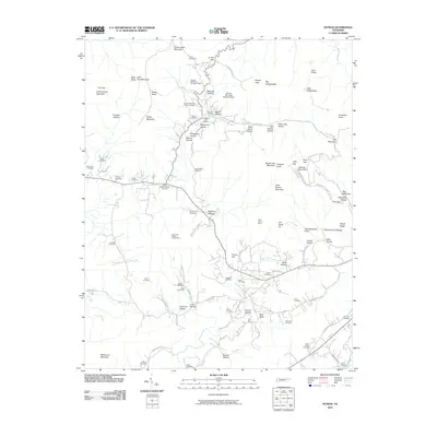
2022 Map of Petros
USGS Topo · Published 2022About this map
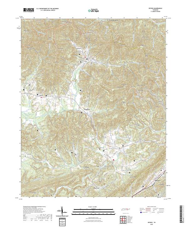
Petros sits at the foot of the Cumberland Mountains, serving as a gateway to the high elevations of Frozen Head Mtn and the prominent Big Brushy Mtn. This topography is defined by the Tennessee Valley Divide, where water begins its journey through systems like Crooked Fork and the Little Emory River. The human landscape is marked by several small communities including Coalfield, Stephens, and Blue Gem, each tied to the winding valley roads. A significant number of local cemeteries, such as the Brushy Mountain Prison Cem and the Mount Pisgah Cem, reflect the area's social history and the presence of the regional correctional facility. The network of trails like the Chimney-Top Trl and Lookout Tower East Trl emphasizes the intersection of natural preservation and early extraction industries, with traces of mining history found along Strip Mines Rd.
Find a feature on this map
113 named features on this map. Tap any name to fly to it.
Don’t see what you’re looking for? This feature index may not catch every label — zoom into the map to look around manually.
Map Details
Editions of this 2022 Petros Map
This is the sole edition of this map. No revisions or reprints were ever made.
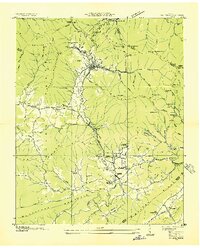
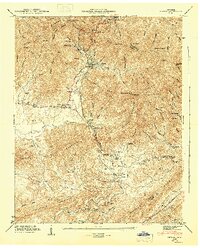
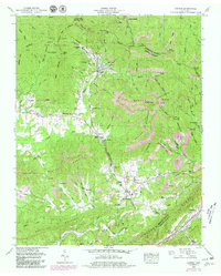
Historical Maps of Union Through Time
8 maps found