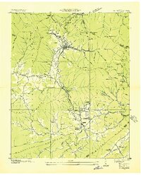
1936 Map of Petros
USGS Topo · Published 1936About this map
Brushy Mountain State Prison sits at the head of the valley in the shadows of Frozen Head Mountain, serving as a major focal point of this 1936 survey. The town of Petros is clearly the center of a bustling industrial landscape, where the Tennessee Railroad and numerous incline tracks serve local coal extraction sites like Frozen Head Mine and Fodder Stack Mine. Further south, the settlements of Coalfield, Coalfield Camp No 1, and Coalfield Camp No 2 reveal the residential footprint of the mining industry.
Find a feature on this map
106 named features on this map. Tap any name to fly to it.
Don’t see what you’re looking for? This feature index may not catch every label — zoom into the map to look around manually.
Map Details
Editions of this 1936 Petros Map
This is the sole edition of this map. No revisions or reprints were ever made.
Other maps of this area

1887 · Kingston
USGS Topo · 1:125,000

1891 · Kingston
USGS Topo · 1:125,000

1893 · Briceville
USGS Topo · 1:125,000

1893 · Kingston
USGS Topo · 1:125,000

1895 · Wartburg
USGS Topo · 1:125,000

1895 · Loudon
USGS Topo · 1:125,000

1895 · Briceville
USGS Topo · 1:125,000

1896 · Wartburg
USGS Topo · 1:125,000

1896 · Briceville
USGS Topo · 1:125,000

1935 · Gobey
USGS Topo · 1:24,000