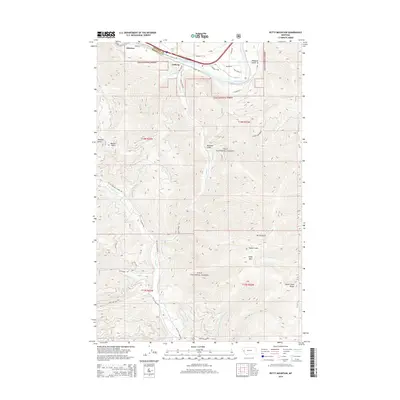
2014 Map of Petty Mountain
USGS Topo · Published 2014About this map
Clark Fork winds through the northern reaches of this landscape, defining the corridor where the settlements of Alberton and Lothrop are situated along Highway 10 W. The terrain is dominated by the steep elevations of the Lolo National Forest, rising sharply toward Petty Mtn and the Grave Creek Range. This 2014 survey reveals a network of forest roads and trails, such as Old Petty Creek Rd and Outback Trl, that navigate the drainages of Petty Cr and Eds Cr. High-elevation water features like Moulton Reservoir Number Two and Martin Spring are tucked away in the gulches, illustrating the complex hydrology of these protected mountains. The map also records the precise administrative boundaries between Mineral and Missoula counties as they cut across the rugged ridges of Ed's Ridge and Peppard Gulch.
Find a feature on this map
45 named features on this map. Tap any name to fly to it.
Don’t see what you’re looking for? This feature index may not catch every label — zoom into the map to look around manually.
Map Details
Editions of this 2014 Petty Mountain Map
This is the sole edition of this map. No revisions or reprints were ever made.
Other maps of this area

1911 · Lolo
USGS Topo · 1:250,000

1912 · Missoula
USGS Topo · 1:125,000

1913 · Lolo
USGS Topo · 1:250,000

1956 · Wallace
USGS Topo · 1:250,000

1956 · Hamilton
USGS Topo · 1:250,000

1959 · Hamilton
USGS Topo · 1:250,000

1959 · Tarkio
USGS Topo · 1:62,500

1959 · Alberton
USGS Topo · 1:62,500

1960 · Wallace
USGS Topo · 1:250,000

1960 · Hamilton
USGS Topo · 1:250,000