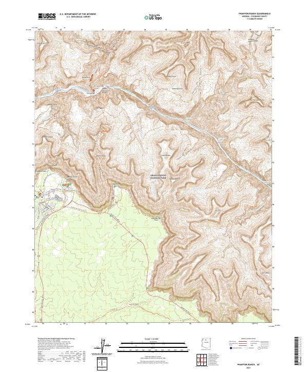
2021 Map of Phantom Ranch
USGS Topo · Published 2021About this map
Phantom Ranch and Indian Garden represent the primary human touchpoints in this rugged vertical landscape, situated along the complex drainage of Bright Angel Creek. The topography is defined by the massive descent into Granite Gorge, where the Colorado River passes beneath engineering feats like the Silver Bridge and the Kaibab Suspension Bridge. To the south, the development of the South Rim is evident through the road and trail networks at Mather Point and Yavapai Point, including the Mather Campground Trail and Trailer Village Road. The map tracks a dense web of backcountry routes, from the Bright Angel Trail to the Arizona National Scenic Trail, connecting high overlooks such as Zoroaster Temple and Cheops Pyramid with the inner canyon's remote springs and rapids.
Find a feature on this map
76 named features on this map. Tap any name to fly to it.
Don’t see what you’re looking for? This feature index may not catch every label — zoom into the map to look around manually.
Map Details
Editions of this 2021 Phantom Ranch Map
This is the sole edition of this map. No revisions or reprints were ever made.
Other maps of this area

1886 · San Francisco Mtns
USGS Topo · 1:250,000

1886 · Chino
USGS Topo · 1:250,000

1886 · Echo Cliffs
USGS Topo · 1:250,000

1886 · Kaibab
USGS Topo · 1:250,000

1891 · San Francisco Mtns
USGS Topo · 1:250,000

1891 · Chino
USGS Topo · 1:250,000

1891 · Echo Cliffs
USGS Topo · 1:250,000

1894 · San Francisco Mtns
USGS Topo · 1:250,000

1899 · San Francisco Mtns
USGS Topo · 1:250,000

1903 · Bright Angel
USGS Topo · 1:48,000