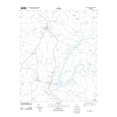
2011 Map of Phil Campbell
USGS Topo · Published 2011About this map
Phil Campbell and Bear Creek anchor this survey of northwest Alabama, where the landscape is defined by the winding paths of Bear Creek and Little Bear Creek. The region shows a dense network of local history, marked by numerous burial grounds such as Mars Hill Cemetery, Center Point Cemetery, and Old Union Cemetery. The presence of Allens Factory and Donaldson Mill reflects the long-standing importance of water power and small-scale industry along these banks. Hydrological management is prominent through the Upper Bear Creek Dam, Lehman Dam, and Davis Mill Dam, which have significantly altered the flow near Cofield Bend and Horseshoe Bend. Named hollows like Devils Den Hollow and Flippo Hollow point to a deeply dissected terrain, while landmarks such as Ikes Knob and Chestnut Ridge provide clear topographical orientation for those tracing family property or regional settlement patterns.
Find a feature on this map
162 named features on this map. Tap any name to fly to it.
Don’t see what you’re looking for? This feature index may not catch every label — zoom into the map to look around manually.
Map Details
Editions of this 2011 Phil Campbell Map
This is the sole edition of this map. No revisions or reprints were ever made.
Other maps of this area

1936 · Newburg
USGS Topo · 1:24,000

1936 · Delmar
USGS Topo · 1:24,000

1936 · Kinlock Spring
USGS Topo · 1:24,000

1936 · Isbell
USGS Topo · 1:24,000

1936 · Phil Campbell
USGS Topo · 1:24,000

1936 · South Of Hackleburg
USGS Topo · 1:24,000

1936 · Hackleburg
USGS Topo · 1:24,000

1936 · Spruce Pine
USGS Topo · 1:24,000

1936 · Goddard
USGS Topo · 1:24,000

1945 · Spruce Pine
USGS Topo · 1:24,000