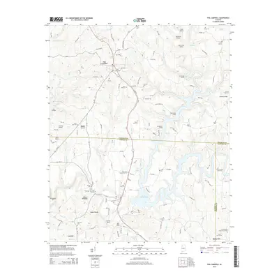
2014 Map of Phil Campbell
USGS Topo · Published 2014About this map
Phil Campbell and Bear Creek serve as the primary hubs in this northwest Alabama landscape, where the borders of Franklin, Marion, and Winston counties converge. The topography is defined by the significant presence of the Upper Bear Creek Reservoir, which winds through the southern half of the quadrangle. Smaller settlements and historically named locales like Shady Grove, Allens Factory, and Lumbull are scattered throughout the region, connected by a network of rural routes such as Al-13 and Trapp Town RD. The map is particularly dense with genealogical sites, featuring over a dozen named burial grounds including Bear Creek Number One Cem, Center Point Cem, and the Shiloh Methodist Church Cem. Along the waterways, numerous bridges like Cummings Bridge and Batestown Bridge facilitate travel across the deep-cut hollows such as Devils Den Hollow and Flippo Hollow, illustrating the community's adaptation to the dissected terrain.
Find a feature on this map
170 named features on this map. Tap any name to fly to it.
Don’t see what you’re looking for? This feature index may not catch every label — zoom into the map to look around manually.
Map Details
Editions of this 2014 Phil Campbell Map
This is the sole edition of this map. No revisions or reprints were ever made.
Other maps of this area

1936 · Newburg
USGS Topo · 1:24,000

1936 · Delmar
USGS Topo · 1:24,000

1936 · Kinlock Spring
USGS Topo · 1:24,000

1936 · Isbell
USGS Topo · 1:24,000

1936 · Phil Campbell
USGS Topo · 1:24,000

1936 · South Of Hackleburg
USGS Topo · 1:24,000

1936 · Hackleburg
USGS Topo · 1:24,000

1936 · Spruce Pine
USGS Topo · 1:24,000

1936 · Goddard
USGS Topo · 1:24,000

1945 · Spruce Pine
USGS Topo · 1:24,000