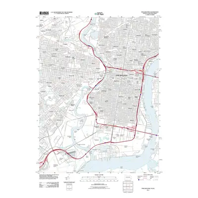
2011 Map of Philadelphia
USGS Topo · Published 2011About this map
The Schuylkill River and Delaware River define the densely urban geography of this 2011 study, flowing through a landscape of historic neighborhoods and modern infrastructure. The map details the academic corridor of West Philadelphia, home to University of Pennsylvania and Drexel University, while the riverfronts show a transition from industrial points like Girard Point to the historic grounds of Fort Mifflin at the confluence. Large-scale public works and institutions are prominent, including the Fairmount Dam and a dense network of postal facilities such as the Philadelphia Main Post Office and the Wanamaker Post Office. Cultural and civic centers are mapped alongside sprawling green spaces like Woodlands Cemetery and Mount Moriah Cemetery, illustrating the long-term patterns of burial and preservation in an ever-evolving city.
Find a feature on this map
132 named features on this map. Tap any name to fly to it.
Don’t see what you’re looking for? This feature index may not catch every label — zoom into the map to look around manually.
Map Details
Editions of this 2011 Philadelphia Map
This is the sole edition of this map. No revisions or reprints were ever made.
Other maps of this area

1891 · Philadelphia
USGS Topo · 1:62,500

1893 · Germantown
USGS Topo · 1:62,500

1894 · Chester
USGS Topo · 1:62,500

1894 · Philadelphia
USGS Topo · 1:62,500

1894 · Norristown
USGS Topo · 1:62,500

1894 · Germantown
USGS Topo · 1:62,500

1895 · Norristown
USGS Topo · 1:62,500

1896 · Germantown
USGS Topo · 1:62,500

1896 · Philadelphia
USGS Topo · 1:62,500

1896 · Norristown
USGS Topo · 1:62,500