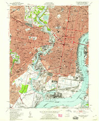
1949 Map of Philadelphia
USGS Topo · Published 1959About this map
The confluence of the Schuylkill River and the Delaware River defines the industrial and civic heart of Philadelphia in the years following World War II. The urban landscape is dense with institutional landmarks, from the University of Pennsylvania and Drexel Inst to the imposing State Penitentiary and Girard College. Significant transit infrastructure dominates the waterfronts, including the Pennsylvania RR lines and the massive Benjamin Franklin Bridge connecting to Camden.
Find a feature on this map
64 named features on this map. Tap any name to fly to it.
Don’t see what you’re looking for? This feature index may not catch every label — zoom into the map to look around manually.
Map Details
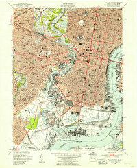
Editions of this 1949 Philadelphia Map
2 editions found
Other maps of this area

1891 · Philadelphia
USGS Topo · 1:62,500

1893 · Germantown
USGS Topo · 1:62,500

1894 · Chester
USGS Topo · 1:62,500

1894 · Philadelphia
USGS Topo · 1:62,500

1894 · Norristown
USGS Topo · 1:62,500

1894 · Germantown
USGS Topo · 1:62,500

1895 · Norristown
USGS Topo · 1:62,500

1896 · Germantown
USGS Topo · 1:62,500

1896 · Philadelphia
USGS Topo · 1:62,500

1896 · Norristown
USGS Topo · 1:62,500