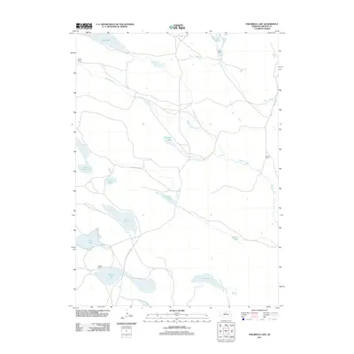
2011 Map of Philbrick Lake
USGS Topo · Published 2011About this map
Oatman Ranch and Tracy Ranch anchor the northern landscape of this Brown County region, where the Calamus River and the South Fork Calamus River wind through the Nebraska Sandhills. The area is defined by a dense concentration of natural basins and seasonal water bodies, including Philbrick Lake, Clapper Lake, and the expansive Moon Lake at the northern boundary.
Find a feature on this map
16 named features on this map. Tap any name to fly to it.
Don’t see what you’re looking for? This feature index may not catch every label — zoom into the map to look around manually.
Map Details
Editions of this 2011 Philbrick Lake Map
This is the sole edition of this map. No revisions or reprints were ever made.
Other maps of this area

1949 · Koshopah
USGS Topo · 1:62,500

1951 · Moon Lake
USGS Topo · 1:62,500

1951 · Koshopah
USGS Topo · 1:62,500

1955 · O'Neill
USGS Topo · 1:250,000

1957 · Valentine
USGS Topo · 1:250,000

1959 · Valentine
USGS Topo · 1:250,000

1959 · O'Neill
USGS Topo · 1:250,000

1969 · O'Neill
USGS Topo · 1:250,000

1982 · Lost Lake Ranch
USGS Topo · 1:24,000
1982 · Goldman Lake NW
USGS Topo · 1:24,000