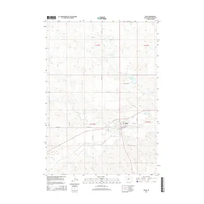
2015 Map of Philip
USGS Topo · Published 2015About this map
Philip serves as the central hub on this Haakon County landscape, situated where the N Fork Bad River and S Fork Bad River converge to form the Bad River. The town's grid is bounded by residential and recreational features like Sunshine Lake to the east and the larger Waggoner Lake to the north, which is accessed via Lake Waggoner Rd. This mid-2010s survey captures the area's vital water-management patterns and local infrastructure, including the winding course of Grindstone Cr and Mexican Cr as they cut through the surrounding ranchlands. The map details the local road network connecting the town to the rural township sections, from E Grindstone Rd to Substation Rd, providing a clear view of the settlement's relationship with its river-defined geography.
Find a feature on this map
33 named features on this map. Tap any name to fly to it.
Don’t see what you’re looking for? This feature index may not catch every label — zoom into the map to look around manually.
Map Details
Editions of this 2015 Philip Map
This is the sole edition of this map. No revisions or reprints were ever made.
Other maps of this area

1953 · Philip Junction
USGS Topo · 1:24,000

1953 · Philip
USGS Topo · 1:24,000

1953 · Philip SE
USGS Topo · 1:24,000

1954 · Kadoka NE
USGS Topo · 1:24,000

1954 · Pierre
USGS Topo · 1:250,000

1955 · Martin
USGS Topo · 1:250,000

1958 · Pierre
USGS Topo · 1:250,000

1958 · Martin
USGS Topo · 1:250,000

1961 · Cottonwood NE
USGS Topo · 1:24,000

1980 · Kadoka
USGS Topo · 1:100,000