2021 Map of Philip
USGS Topo · Published 2021About this map
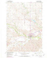
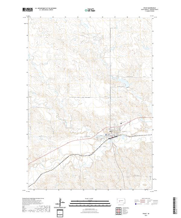
Philip serves as the focal point of this South Dakota landscape, situated at the confluence of several significant watercourses. The town is the site of the Haakon County Courthouse and serves as a local hub for the surrounding ranching and agricultural lands. The hydrology of the region is well-defined, showing the Bad River and its major tributaries, the N Fork Bad River and S Fork Bad River, winding through the terrain. To the north, Grindstone Cr and Mexican Cr carve through the plains, while the small Sunshine Lake sits on the eastern edge of the settlement. Local history is anchored by the Masonic Cem located just north of the town center, while a grid of section-line roads like 217th Ave and 221st Ave organizes the wide-open prairie surrounding the community.
Find a feature on this map
35 named features on this map. Tap any name to fly to it.
Don’t see what you’re looking for? This feature index may not catch every label — zoom into the map to look around manually.
Map Details
Editions of this 2021 Philip Map
This is the sole edition of this map. No revisions or reprints were ever made.
Historical Maps of Philip Through Time
4 maps found