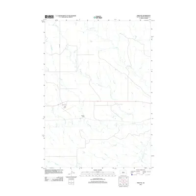
2012 Map of Philip SE
USGS Topo · Published 2012About this map
Bad River and its network of northern tributaries carve through the Haakon County landscape, defining the hydrology of this rural South Dakota region. The area's drainage pattern is dominated by the winding paths of Wilburn Cr, Medicine Cr, and Grindstone Cr, which converge as they move toward the larger river valley. In this sparsely populated prairie terrain, transportation and infrastructure are centered around the Philip Airport and the corridor of 225th Ave. The terrain is further distinguished by Belcher Draw, illustrating the natural erosion patterns common to the western river basins. This survey provides a clear look at the relationship between the occasional ranch road and the persistent watercourses like White Willow Cr that have shaped local geography for generations.
Find a feature on this map
9 named features on this map. Tap any name to fly to it.
Don’t see what you’re looking for? This feature index may not catch every label — zoom into the map to look around manually.
Map Details
Editions of this 2012 Philip SE Map
This is the sole edition of this map. No revisions or reprints were ever made.
Other maps of this area

1953 · Philip Junction
USGS Topo · 1:24,000

1953 · Philip
USGS Topo · 1:24,000

1953 · Philip SE
USGS Topo · 1:24,000

1954 · Belvidere NW
USGS Topo · 1:24,000

1954 · Kadoka NE
USGS Topo · 1:24,000

1954 · Powell
USGS Topo · 1:24,000

1954 · Pierre
USGS Topo · 1:250,000

1955 · Martin
USGS Topo · 1:250,000

1958 · Pierre
USGS Topo · 1:250,000

1958 · Martin
USGS Topo · 1:250,000