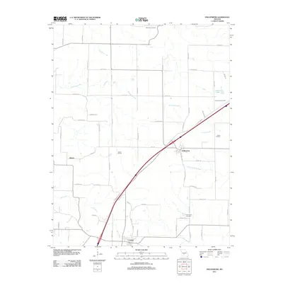
2011 Map of Phillipsburg
USGS Topo · Published 2011About this map
Phillipsburg and the northern edge of Conway anchor this section of Laclede County, defined by the diagonal transit corridor that cuts through the southwestern Missouri landscape. The terrain is characterized by a network of drainage systems, including the winding Dousinbury Creek, Brush Creek, and Jones Creek, which have influenced the placement of local homesteads and small family burial grounds.
Find a feature on this map
56 named features on this map. Tap any name to fly to it.
Don’t see what you’re looking for? This feature index may not catch every label — zoom into the map to look around manually.
Map Details
Editions of this 2011 Phillipsburg Map
This is the sole edition of this map. No revisions or reprints were ever made.
Other maps of this area

1939 · Long Lane
USGS Topo · 1:62,500

1941 · Lebanon
USGS Topo · 1:62,500

1942 · Long Lane
USGS Topo · 1:62,500

1943 · Lebanon
USGS Topo · 1:62,500

1946 · Niangua
USGS Topo · 1:62,500

1948 · Niangua
USGS Topo · 1:62,500

1954 · Springfield
USGS Topo · 1:250,000

1956 · Rader
USGS Topo · 1:24,000

1958 · Springfield
USGS Topo · 1:250,000

1959 · Springfield
USGS Topo · 1:250,000