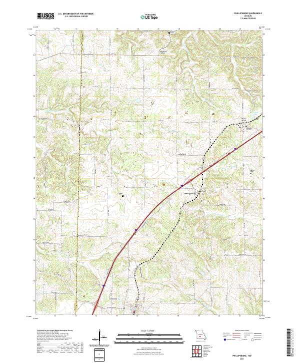
2021 Map of Phillipsburg
USGS Topo · Published 2021About this map
The Laclede and Dallas county line divides this landscape where the Ozark plateau meets the drainage of the Gasconade River basin. Phillipsburg and the northern edge of Conway serve as the primary hubs, linked by the modern highway corridor that overlays the path of the legendary Hst Rte 66. The terrain is defined by a network of winding creek valleys, including Dousinbury Cr and Brush Cr, which have carved deep local depressions like Dogwood Hollow. For genealogists, the map reveals several dispersed burial grounds that speak to the area's rural settlement patterns, including Lonesome Hill Cem to the northeast and Shanks Cem near the center of the quadrangle. Small-scale water features like Jacobs Lake and the various branches of Spring Hollow Cr illustrate the complex hydrology that historically influenced farm placement and early road development in this part of Missouri.
Find a feature on this map
77 named features on this map. Tap any name to fly to it.
Don’t see what you’re looking for? This feature index may not catch every label — zoom into the map to look around manually.
Map Details
Editions of this 2021 Phillipsburg Map
This is the sole edition of this map. No revisions or reprints were ever made.
Other maps of this area

1939 · Long Lane
USGS Topo · 1:62,500

1941 · Lebanon
USGS Topo · 1:62,500

1942 · Long Lane
USGS Topo · 1:62,500

1943 · Lebanon
USGS Topo · 1:62,500

1946 · Niangua
USGS Topo · 1:62,500

1948 · Niangua
USGS Topo · 1:62,500

1954 · Springfield
USGS Topo · 1:250,000

1956 · Rader
USGS Topo · 1:24,000

1958 · Springfield
USGS Topo · 1:250,000

1959 · Springfield
USGS Topo · 1:250,000