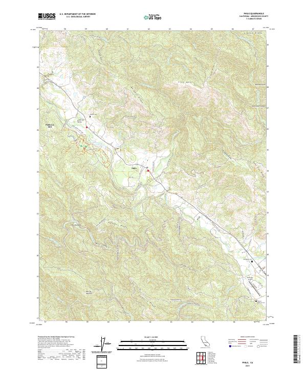
2021 Map of Philo
USGS Topo · Published 2021About this map
The Navarro River cuts through the heart of this Mendocino County landscape, where the settlement of Philo sits at the junction of several mountain-and-valley routes. This area is defined by its ridge-and-canyon topography, featuring prominent landmarks like Clow Mtn and Peterson Ridge. The valley floor preserves important local heritage sites, including Shields Cem and the Philbrick Mill, indicating a history of early industry and settlement near the riverbanks.
Find a feature on this map
77 named features on this map. Tap any name to fly to it.
Don’t see what you’re looking for? This feature index may not catch every label — zoom into the map to look around manually.
Map Details
Editions of this 2021 Philo Map
This is the sole edition of this map. No revisions or reprints were ever made.
Other maps of this area

1943 · Point Arena
USGS Topo · 1:62,500

1943 · Boonville
USGS Topo · 1:62,500

1943 · Navarro
USGS Topo · 1:62,500

1943 · Ornbaun
USGS Topo · 1:62,500

1944 · Saddle Point
USGS Topo · 1:62,500

1944 · Ornbaun
USGS Topo · 1:62,500

1947 · Santa Rosa
USGS Topo · 1:250,000

1949 · Santa Rosa
USGS Topo · 1:250,000

1957 · Ukiah
USGS Topo · 1:250,000

1958 · Santa Rosa
USGS Topo · 1:250,000