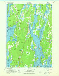
1957 Map of Phippsburg
USGS Topo · Published 1959About this map
Phippsburg and the surrounding coastal reaches of Sagadahoc County are defined by a complex geography of tidal inlets and granite ridges as they appeared in the late 1950s. The mouth of the Kennebec River is dominated by significant historical military and maritime infrastructure, notably Fort Popham and the Fort Baldwin US Military Reservation guarding the entrance to Atkins Bay. Settlement patterns follow the narrow necks of land, with clusters at Popham Beach, Sebasco Estates, and Georgetown. Inland industry is marked by the Old Mica Mine and several Quarries near Todd Bay, illustrating the area's reliance on natural resource extraction alongside its maritime heritage. To the north, the historic connection of Winnegance bridges the gap between the Kennebec and Winnegance Bay, while numerous smaller communities like Ashdale and Parker Head are linked by the winding coastal roads.
Find a feature on this map
114 named features on this map. Tap any name to fly to it.
Don’t see what you’re looking for? This feature index may not catch every label — zoom into the map to look around manually.
Map Details
Editions of this 1957 Phippsburg Map
2 editions found
Other maps of this area

1893 · Small Point
USGS Topo · 1:62,500

1893 · Boothbay
USGS Topo · 1:62,500

1894 · Bath
USGS Topo · 1:62,500

1919 · Small Point
USGS Topo · 1:62,500

1920 · Bath
USGS Topo · 1:62,500

1941 · Boothbay
USGS Topo · 1:62,500

1943 · Boothbay
USGS Topo · 1:62,500

1944 · Boothbay
USGS Topo · 1:62,500

1944 · Small Point
USGS Topo · 1:62,500

1945 · Bath
USGS Topo · 1:62,500