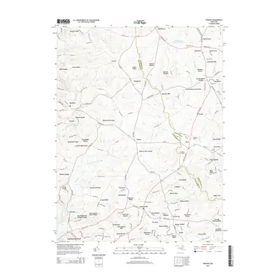
2014 Map of Phoenix
USGS Topo · Published 2014About this map
Gunpowder Falls and Little Gunpowder Falls carve through this landscape along the border of Baltimore and Harford Counties, anchoring a region of established rural settlements and evolving residential manors. The map reveals a dense network of historic locales such as Monkton, Jarrettsville, and Corbett, many of which developed around early milling sites like Hunters Mill and Houcks Mill. The topography is defined by numerous drainage runs, including Charles Run and My Ladys Manor Br, which separate the various farms and residential developments. Genealogists will find value in the location of Bethel Cem near Little Deer Creek Reservoir Number 3 and the Good Will Cem in the east. The naming conventions of modern developments, such as Kinhart Manor and Fox Meadows Purchase, reflect the area's transition from traditional agricultural use to suburban estate communities.
Find a feature on this map
185 named features on this map. Tap any name to fly to it.
Don’t see what you’re looking for? This feature index may not catch every label — zoom into the map to look around manually.
Map Details
Editions of this 2014 Phoenix Map
This is the sole edition of this map. No revisions or reprints were ever made.
Other maps of this area

1893 · Gunpowder
USGS Topo · 1:62,500

1894 · Baltimore
USGS Topo · 1:62,500

1898 · Tolchester
USGS Topo · 1:125,000

1899 · Baltimore
USGS Topo · 1:62,500

1900 · Parkton
USGS Topo · 1:62,500

1901 · Belair
USGS Topo · 1:62,500

1901 · Gunpowder
USGS Topo · 1:62,500

1902 · Parkton
USGS Topo · 1:62,500

1903 · Tolchester
USGS Topo · 1:125,000

1904 · Baltimore
USGS Topo · 1:62,500
Featured Places
- Pleasant Prospect at Glen Elyn, MD
- Vance Valley, MD
- Brookfield, MD
- Cool Meadows Farms, MD
- Blackhorse, MD