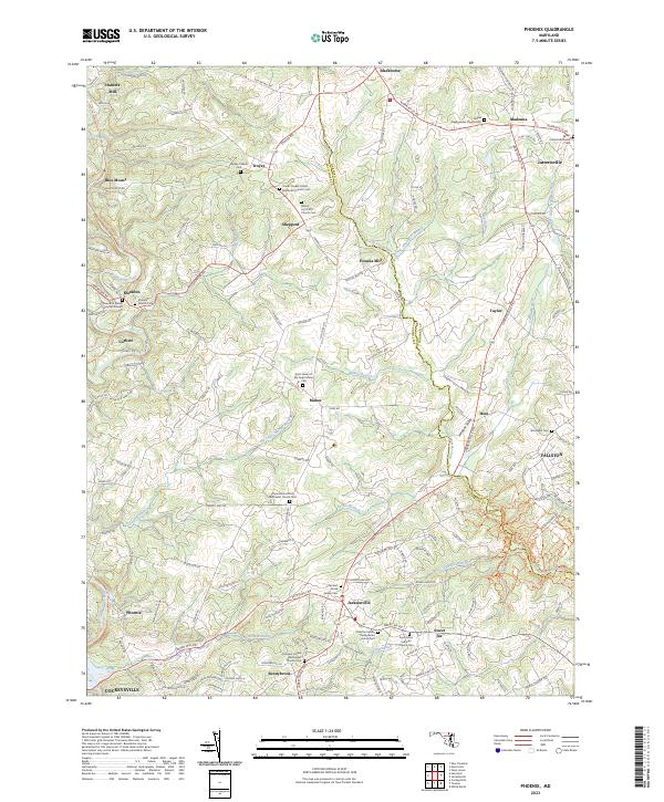
2023 Map of Phoenix
USGS Topo · Published 2023About this map
The Maryland countryside north of Cockeysville is defined by a dense network of family-named crossroads and the winding courses of the Gunpowder Falls and Little Gunpowder Falls. This landscape preserves deep genealogical roots through its numerous historic congregations and burial grounds, including the Meredith Family Burying Ground near Monkton and the Saint James of My Ladys Manor Cem near Manor. The transition from old industrial sites like Hunters Mill and Houcks Mill to modern recreation is evident in the Torrey C Brown Rail Trl, which follows the former rail corridor through Corbett and Blue Mount. Settlements such as Jacksonville, Jarrettsville, and Phoenix anchor the rural terrain, where small branches like Overshot Run and Greene Branch drain the rolling hills along the border of Baltimore and Harford counties.
Find a feature on this map
160 named features on this map. Tap any name to fly to it.
Don’t see what you’re looking for? This feature index may not catch every label — zoom into the map to look around manually.
Map Details
Editions of this 2023 Phoenix Map
This is the sole edition of this map. No revisions or reprints were ever made.
Other maps of this area

1893 · Gunpowder
USGS Topo · 1:62,500

1894 · Baltimore
USGS Topo · 1:62,500

1898 · Tolchester
USGS Topo · 1:125,000

1899 · Baltimore
USGS Topo · 1:62,500

1900 · Parkton
USGS Topo · 1:62,500

1901 · Belair
USGS Topo · 1:62,500

1901 · Gunpowder
USGS Topo · 1:62,500

1902 · Parkton
USGS Topo · 1:62,500

1903 · Tolchester
USGS Topo · 1:125,000

1904 · Baltimore
USGS Topo · 1:62,500