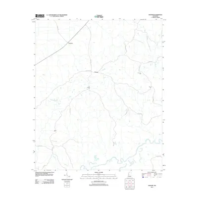
2012 Map of Phoenix
USGS Topo · Published 2012About this map
The Big Black River meanders across the southern portion of this landscape, defining the rural geography of southern Yazoo County near the turn of the 21st century. The unincorporated community of Phoenix serves as a central point for the surrounding countryside, connected by a network of winding roads like Russellville Rd and Mechanicsburg Rd. This 2012 survey provides significant detail for genealogists, documenting family-named burial sites such as Hart Childress Cem and Marley Cem that are often the only remaining markers of early pioneer families in the area.
Find a feature on this map
24 named features on this map. Tap any name to fly to it.
Don’t see what you’re looking for? This feature index may not catch every label — zoom into the map to look around manually.
Map Details
Editions of this 2012 Phoenix Map
This is the sole edition of this map. No revisions or reprints were ever made.
Other maps of this area

1903 · Jackson
USGS Topo · 1:125,000

1934 · Raymond
USGS Topo · 1:48,000

1937 · Raymond
USGS Topo · 1:62,500

1938 · Edwards
USGS Topo · 1:62,500

1940 · Mechanicsburg
USGS Topo · 1:62,500

1942 · Raymond
USGS Topo · 1:62,500

1955 · Jackson
USGS Topo · 1:250,000

1961 · Jackson
USGS Topo · 1:250,000

1962 · Jackson
USGS Topo · 1:250,000

1962 · Flora
USGS Topo · 1:62,500