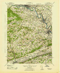
1943 Map of Phoenixville
USGS Topo · Published 1943About this map
The Schuylkill River carves a winding path through this industrial and agricultural corridor during the early 1940s, serving as the primary geographic anchor for established river towns like Phoenixville, Spring City, and Pottstown. The landscape is a complex network of transportation, where the Reading Railroad and Pennsylvania Railroad parallel the river's course, supporting the region's manufacturing centers. This edition captures a significant moment in Pennsylvania's infrastructure history, showing the Pennsylvania Turnpike cutting across the southern townships of Uwchlan and West Whiteland.
Find a feature on this map
137 named features on this map. Tap any name to fly to it.
Don’t see what you’re looking for? This feature index may not catch every label — zoom into the map to look around manually.
Map Details
Editions of this 1943 Phoenixville Map
This is the sole edition of this map. No revisions or reprints were ever made.
Other maps of this area

1888 · Quakertown
USGS Topo · 1:62,500

1890 · Quakertown
USGS Topo · 1:62,500

1894 · Reading
USGS Topo · 1:62,500

1894 · Quakertown
USGS Topo · 1:62,500

1894 · Chester
USGS Topo · 1:62,500

1894 · Norristown
USGS Topo · 1:62,500

1895 · Norristown
USGS Topo · 1:62,500

1896 · Norristown
USGS Topo · 1:62,500

1896 · Chester
USGS Topo · 1:62,500

1898 · Chester
USGS Topo · 1:62,500