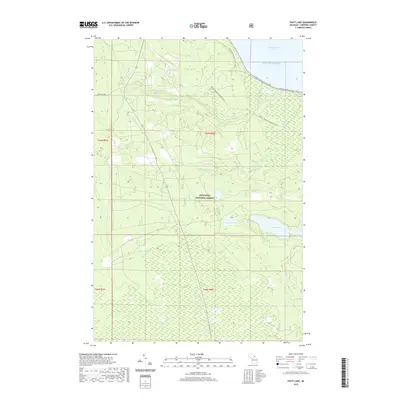
2019 Map of Piatt Lake
USGS Topo · Published 2019About this map
Lake Superior defines the northern edge of this landscape, where the waters of Tahquamenon Bay meet a coastline marked by specialized trails and forest management. Much of the terrain is contained within the Hiawatha National Forest, showing a network of wetlands and small water bodies like Piatt Lake, Duck Lake, and Johnson Lake. The map illustrates the contemporary intersection of recreation and conservation, featuring the N Country National Scenic Trail as it winds near the coast and the Raco - Paradise Snomo (Snow) route cutting through the timberland. Drainage patterns are dictated by several small waterways including Roxbury Cr and Cr Number Fourteen, which flow through the low-lying, wooded tracts of the Upper Peninsula.
Find a feature on this map
18 named features on this map. Tap any name to fly to it.
Don’t see what you’re looking for? This feature index may not catch every label — zoom into the map to look around manually.
Map Details
Editions of this 2019 Piatt Lake Map
This is the sole edition of this map. No revisions or reprints were ever made.
Other maps of this area

1941 · Strongs
USGS Topo · 1:63,360

1951 · Strongs
USGS Topo · 1:24,000

1951 · McNearney Lake
USGS Topo · 1:24,000

1951 · Emerson
USGS Topo · 1:24,000

1951 · Piatt Lake
USGS Topo · 1:24,000

1951 · Big Beaver Creek
USGS Topo · 1:24,000

1951 · Hulbert
USGS Topo · 1:24,000

1951 · Eckerman
USGS Topo · 1:24,000

1951 · Timberlost
USGS Topo · 1:24,000

1951 · Strongs
USGS Topo · 1:62,500