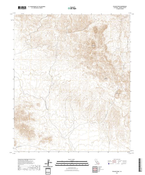
2021 Map of Picacho Peak
USGS Topo · Published 2021About this map
Picacho Peak rises as a prominent landmark over this desert landscape in Imperial County, defining a region where dry washes like Bear Canyon cut through complex terrain. The map captures the network of remote roads that facilitate access through these arid reaches, most notably Picacho Rd and the distinctly named Barney Oldfield Rd. Small-scale infrastructure is visible at Arturos Bridge, providing a crossing point in a land otherwise dominated by natural features like Pebble Mtn. This modern survey illustrates the enduring topographic character of the region, showing how contemporary tracks follow the natural contours of the canyons and ridges of the Colorado Desert.
Find a feature on this map
13 named features on this map. Tap any name to fly to it.
Don’t see what you’re looking for? This feature index may not catch every label — zoom into the map to look around manually.
Map Details
Editions of this 2021 Picacho Peak Map
This is the sole edition of this map. No revisions or reprints were ever made.
Other maps of this area

1903 · Yuma
USGS Topo · 1:125,000

1905 · Yuma
USGS Topo · 1:125,000

1942 · Yuma
USGS Topo · 1:250,000

1942 · Blythe
USGS Topo · 1:250,000

1945 · Picacho Peak
USGS Topo · 1:62,500

1945 · Picacho
USGS Topo · 1:62,500

1951 · Picacho
USGS Topo · 1:62,500

1951 · Picacho Peak
USGS Topo · 1:62,500

1952 · Araz
USGS Topo · 1:24,000
1952 · Bard
USGS Topo · 1:24,000