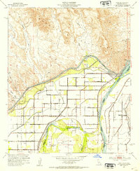
1952 Map of Bard
USGS Topo · Published 1954About this map
The Colorado River and its complex irrigation network define this desert landscape where California and Arizona meet. In the early 1950s, the All American Canal and various reservation mains carved a path through the Gila Valley, supporting local agriculture and settlements like Bard and Ross Corner. The transition from the rugged Choco Mountains in the north to the fertile river bottomlands is stark, showing the intensive land management within the Yuma Indian Reservation.
Find a feature on this map
37 named features on this map. Tap any name to fly to it.
Don’t see what you’re looking for? This feature index may not catch every label — zoom into the map to look around manually.
Map Details
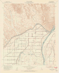
Editions of this 1952 Bard Map
2 editions found
Other maps of this area

1903 · Yuma
USGS Topo · 1:125,000

1905 · Yuma
USGS Topo · 1:125,000

1926 · Fortuna
USGS Topo · 1:62,500

1929 · Fortuna
USGS Topo · 1:62,500

1929 · Laguna
USGS Topo · 1:62,500

1940 · Yuma
USGS Topo · 1:62,500

1942 · Yuma
USGS Topo · 1:250,000

1943 · Laguna
USGS Topo · 1:62,500

1945 · Picacho Peak
USGS Topo · 1:62,500

1945 · Yuma
USGS Topo · 1:62,500