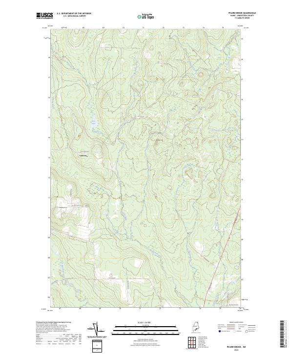
2024 Map of Picard Brook
USGS Topo · Published 2024About this map
California stands as a primary settlement point within this northern Aroostook County landscape, situated near the intersection of California Rd and Swedberg Rd. The terrain is defined by a dense network of waterways, including the Little Madawaska River in the southwest and the central flow of Halfway Brook. Higher ground is marked by prominent elevations such as Stockholm Mtn and Moose Hill, while smaller water bodies like Mud Lake dot the northern reaches. The road network reflects the region's rural character, with routes like Jemtland Rd and Stockholm Rd providing access to the more isolated areas. This modern survey illustrates a landscape of managed forests and remote drainages, where local life remains centered around a few key thoroughfares and the many tributaries, such as Violette Brook and Picard Brook, that feed the larger river systems of the Maine woods.
Find a feature on this map
24 named features on this map. Tap any name to fly to it.
Don’t see what you’re looking for? This feature index may not catch every label — zoom into the map to look around manually.
Map Details
Editions of this 2024 Picard Brook Map
This is the sole edition of this map. No revisions or reprints were ever made.
Other maps of this area

1921 · Van Buren
USGS Topo · 1:250,000

1927 · Stockholm
USGS Topo · 1:48,000

1929 · Caribou
USGS Topo · 1:48,000

1930 · Fort Fairfield
USGS Topo · 1:48,000

1931 · Van Buren
USGS Topo · 1:48,000

1931 · Stockholm
USGS Topo · 1:62,500

1932 · Caribou
USGS Topo · 1:62,500

1933 · Fort Fairfield
USGS Topo · 1:62,500

1934 · Van Buren
USGS Topo · 1:62,500

1951 · Van Buren
USGS Topo · 1:62,500