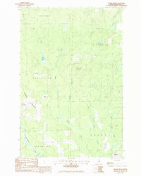
1986 Map of Picard Brook
USGS Topo · Published 1986About this map
Stockholm and New Sweden anchor the southern reaches of this Maine landscape, reflecting the unique Swedish immigrant heritage that defined this corner of Aroostook County. The terrain is marked by a network of waterways and low ridges, where the Little Madawaska River winds through the southwestern corner near Beardsley Bk. The map captures a transitional geography of managed timberlands and small-scale agriculture, evidenced by features like the Gravel Pit near the river and the expansive Cyr Plantation to the north. Higher ground is defined by Stockholm Mountain and Moose Hill, while isolated settlements like California sit tucked between Mud Brook and Halfway Brook. In the southeast, a U.S. Military Reservation and a prominent Radio Tower indicate the strategic importance of this borderland region during the late twentieth century.
Find a feature on this map
21 named features on this map. Tap any name to fly to it.
Don’t see what you’re looking for? This feature index may not catch every label — zoom into the map to look around manually.
Map Details
Editions of this 1986 Picard Brook Map
This is the sole edition of this map. No revisions or reprints were ever made.
Other maps of this area

1921 · Van Buren
USGS Topo · 1:250,000

1927 · Stockholm
USGS Topo · 1:48,000

1929 · Caribou
USGS Topo · 1:48,000

1930 · Fort Fairfield
USGS Topo · 1:48,000

1931 · Van Buren
USGS Topo · 1:48,000

1931 · Stockholm
USGS Topo · 1:62,500

1932 · Caribou
USGS Topo · 1:62,500

1933 · Fort Fairfield
USGS Topo · 1:62,500

1934 · Van Buren
USGS Topo · 1:62,500

1951 · Van Buren
USGS Topo · 1:62,500