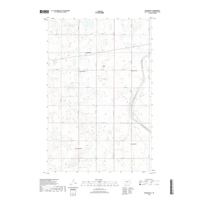
2018 Map of Pickardville
USGS Topo · Published 2018About this map
Pickardville remains the primary settlement in this prairie landscape, situated where the terrain begins to rise toward features like Klinks Slope. The most significant engineering feature on the sheet is the McClusky Canal, which cuts a distinctive path through the southeastern portion of the quadrangle. Modern recreation is represented by the N Country National Scenic Trail, which winds through the eastern sections, following the contours of the land near the canal. The map provides a detailed look at the rural township grid, illustrating the transition between cultivated fields and the native water bodies that dot the Sheridan County plains.
Find a feature on this map
9 named features on this map. Tap any name to fly to it.
Don’t see what you’re looking for? This feature index may not catch every label — zoom into the map to look around manually.
Map Details
Editions of this 2018 Pickardville Map
This is the sole edition of this map. No revisions or reprints were ever made.
Other maps of this area

1945 · Pelican Lake
USGS Topo · 1:62,500

1947 · Pelican Lake
USGS Topo · 1:62,500

1947 · Lincoln Valley
USGS Topo · 1:62,500

1954 · McClusky
USGS Topo · 1:250,000

1958 · McClusky
USGS Topo · 1:250,000

1959 · Pickardville
USGS Topo · 1:24,000

1959 · Mercer
USGS Topo · 1:24,000

1959 · Mercer SW
USGS Topo · 1:24,000

1959 · Mercer SE
USGS Topo · 1:24,000

1959 · McClusky
USGS Topo · 1:24,000