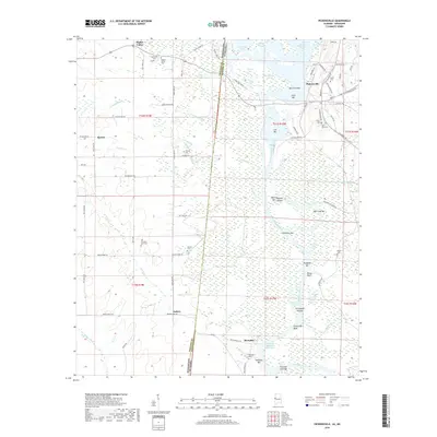
2018 Map of Pickensville
USGS Topo · Published 2018About this map
Pickensville sits at a critical bend of the Tombigbee River, serving as a focal point for this borderland where Alabama meets Mississippi. The landscape is defined by the massive infrastructure of the Tennessee-Tombigbee Waterway, which reshaped the river's natural course with the Pickensville Cut Off and the Coalfire Cut Off. These engineering feats bypassed older river features like Bell Ford Bar and Ford Bar, though many original oxbows and sloughs like Clear Lake remain.
Find a feature on this map
97 named features on this map. Tap any name to fly to it.
Don’t see what you’re looking for? This feature index may not catch every label — zoom into the map to look around manually.
Map Details
Editions of this 2018 Pickensville Map
This is the sole edition of this map. No revisions or reprints were ever made.
Other maps of this area

1953 · West Point
USGS Topo · 1:250,000

1958 · West Point
USGS Topo · 1:250,000

1960 · Columbus
USGS Topo · 1:62,500

1963 · West Point
USGS Topo · 1:250,000

1966 · Reform SW
USGS Topo · 1:24,000

1970 · Aliceville North
USGS Topo · 1:24,000

1970 · Aliceville South
USGS Topo · 1:24,000

1973 · Cliftonville
USGS Topo · 1:24,000

1973 · McLeod
USGS Topo · 1:24,000
1974 · Dancy
USGS Topo · 1:24,000