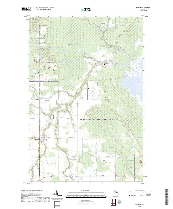
2023 Map of Pickford
USGS Topo · Published 2023About this map
Pickford sits at the junction of Meridian Rd and M 129, serving as a central point in this agricultural landscape of the eastern Upper Peninsula. The drainage network of the Munuscong River and its various tributaries, including the East Branch Munuscong River and Little Munuscong River, dictates the placement of settlements and roads. Small rural hubs like Stirlingville and Kelden appear along the waterways, connected by a rigid grid of section-line roads like E 22 Mile Rd and S Keldon Rd. Genealogy researchers can find several burial sites preserved across these sections, including Bethel Cem to the west and Old Kelden Cem and Fairview Cem to the east. The terrain is characterized by winding creeks like Demoreux Creek and School Creek which snake through the level fields and wetland areas between the Mackinac and Chippewa county line.
Find a feature on this map
67 named features on this map. Tap any name to fly to it.
Don’t see what you’re looking for? This feature index may not catch every label — zoom into the map to look around manually.
Map Details
Editions of this 2023 Pickford Map
This is the sole edition of this map. No revisions or reprints were ever made.
Other maps of this area

1913 · Sault Sainte Marie
USGS Topo · 1:62,500

1919 · Neebish
USGS Topo · 1:62,500

1931 · Pickford SE
USGS Topo · 1:31,680

1941 · Neebish
USGS Topo · 1:63,360

1941 · Sault Sainte Marie
USGS Topo · 1:63,360

1951 · Dafter
USGS Topo · 1:24,000

1951 · Barbeau
USGS Topo · 1:24,000

1951 · Oak Ridge
USGS Topo · 1:24,000

1951 · Sault Ste. Marie
USGS Topo · 1:62,500

1951 · Lake George
USGS Topo · 1:62,500