
1931 Map of Pickford SE
USGS Topo · Published 1931About this map
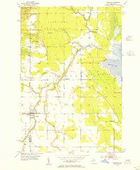
Pickford serves as the primary hub in this 1931 survey of the Eastern Upper Peninsula, where the landscape transitions from agricultural clearings to the dense wetlands of Clark Township. The region is defined by its water network, from the winding Munuscong River in the north to the swampy reaches around Leach Lake and Mud L. Early 20th-century transportation is clearly delineated, showing the alignment of US Hy No 2 and State Highway No 48 before modern highway realignments. For local historians, the placement of rural educational centers like Tripp Sch, Woodlawn Sch, and Izzard Sch provides a look at the social geography of this Mackinac and Chippewa county borderland during the interwar years. Near Rockview, the map notes the presence of extractive activity, grounding the area's early economy in both timber and stone.
Find a feature on this map
21 named features on this map. Tap any name to fly to it.
Don’t see what you’re looking for? This feature index may not catch every label — zoom into the map to look around manually.
Map Details
Editions of this 1931 Pickford SE Map
This is the sole edition of this map. No revisions or reprints were ever made.
Other maps of this area

1953 · Munuscong
USGS Topo · 1:24,000

1953 · Pickford NW
USGS Topo · 1:24,000
1953 · Pickford
USGS Topo · 1:24,000

1954 · Sault Sainte Marie
USGS Topo · 1:250,000

1955 · Cheboygan
USGS Topo · 1:250,000

1956 · Sault Sainte Marie
USGS Topo · 1:250,000

1957 · Sault Sainte Marie
USGS Topo · 1:250,000

1958 · Cheboygan
USGS Topo · 1:250,000

1958 · Sault Sainte Marie
USGS Topo · 1:250,000
1964 · Stalwart
USGS Topo · 1:24,000