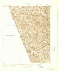
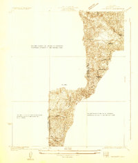
1929 Map of Pico
USGS Topo · Published 1929About this map
Pico Oil Field sits at the heart of this 1929 industrial landscape, marking a significant era of petroleum extraction in the Santa Susana Mountains. The terrain is dominated by a complex network of drainages including Pico Canyon, Towsley Canyon, and Las Llajas Canyon, which carve through the high elevations of the San Francisco region. These canyons served as the primary conduits for early access to oil leases and mountain grazing lands.
Find a feature on this map
16 named features on this map. Tap any name to fly to it.
Don’t see what you’re looking for? This feature index may not catch every label — zoom into the map to look around manually.
Map Details
Editions of this 1929 Pico Map
This is the sole edition of this map. No revisions or reprints were ever made.
Other maps of this area

1903 · Camulos
USGS Topo · 1:125,000

1903 · Santa Susana
USGS Topo · 1:62,500

1925 · Chatsworth
USGS Topo · 1:24,000

1927 · Chatsworth
USGS Topo · 1:24,000
1928 · Zelzah
USGS Topo · 1:24,000
1929 · Zelzah
USGS Topo · 1:24,000
1929 · Newhall
USGS Topo · 1:24,000
1929 · Chatsworth
USGS Topo · 1:24,000

1929 · Saugus
USGS Topo · 1:24,000

1931 · Santa Felicia Canyon
USGS Topo · 1:24,000
Featured Places
- Simi Valley, CA
- La Quinta, Unincorporated Chatsworth
- Pico, CA
- Mentryville, CA
- Unincorporated Chatsworth, CA