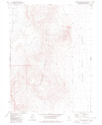
1980 Map of Pidgeon Spring SW
USGS Topo · Published 1980About this map
The Black Rock Range dominates the western half of this 1980 survey, characterized by sharp elevation changes and deep drainage patterns. To the east, the landscape transitions into the flat expanse of the Black Rock Desert, a playa where the mapping identifies numerous bench marks such as BM 3970 and BM 3959 along a corridor of light-duty and unimproved roads. Traces of human activity are sparse but notable, including a solitary Prospect located near the southern boundary, reflecting the region's history of mineral exploration. Transport through this arid terrain relied on a network of unpaved paths, ranging from a standard Trail to a more rugged Jeep Trail, while the presence of a single Spring in the northwest corner highlights the critical and rare nature of water sources in this high-desert environment.
Find a feature on this map
18 named features on this map. Tap any name to fly to it.
Don’t see what you’re looking for? This feature index may not catch every label — zoom into the map to look around manually.
Map Details
Editions of this 1980 Pidgeon Spring SW Map
This is the sole edition of this map. No revisions or reprints were ever made.
Other maps of this area

1886 · Disaster
USGS Topo · 1:250,000

1886 · Granite Range
USGS Topo · 1:250,000

1889 · Long Valley
USGS Topo · 1:250,000

1893 · Disaster
USGS Topo · 1:250,000

1894 · Granite Range
USGS Topo · 1:250,000

1931 · Lovelock
USGS Topo · 1:250,000

1935 · Lovelock
USGS Topo · 1:250,000

1954 · Vya
USGS Topo · 1:250,000

1955 · Lovelock
USGS Topo · 1:250,000

1958 · Vya
USGS Topo · 1:250,000