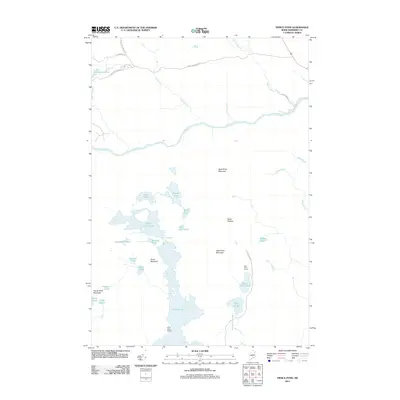
2011 Map of Pierce Pond
USGS Topo · Published 2011About this map
Pierce Pond and its intricate network of surrounding waters dominate this landscape in Somerset County, where the Dead River flows eastward across the northern half of the quadrangle. The map reveals a remote geography of interconnected ponds and steep ridges, characterized by the narrow passage of Caribou Narrows and the rapids at Poplar Hill Falls. Human presence is concentrated around sporting and wilderness outposts, specifically the Otter Pond Camps and Pierce Pond Camps, which have long served as anchors for backcountry recreation.
Find a feature on this map
37 named features on this map. Tap any name to fly to it.
Don’t see what you’re looking for? This feature index may not catch every label — zoom into the map to look around manually.
Map Details
Editions of this 2011 Pierce Pond Map
This is the sole edition of this map. No revisions or reprints were ever made.
Other maps of this area

1903 · Bingham
USGS Topo · 1:62,500

1905 · Bingham
USGS Topo · 1:62,500

1905 · The Forks
USGS Topo · 1:62,500

1907 · The Forks
USGS Topo · 1:62,500

1925 · Pierce Pond
USGS Topo · 1:48,000

1927 · Pierce Pond
USGS Topo · 1:62,500

1928 · Dead River
USGS Topo · 1:62,500

1931 · Dead River
USGS Topo · 1:48,000

1944 · Dead River
USGS Topo · 1:62,500

1944 · Pierce Pond
USGS Topo · 1:62,500
Featured Places
- West Forks, ME
- Bowtown Township, ME
- Pierce Pond Township, ME
- Lower Enchanted Township, ME
- Somerset County, ME